RiverWatch: a citizen-science approach to river pollution monitoring
from 01/10/2023 until 28/02/2026
Under unprecedented pressure from urbanization and
climate change, an ever increasing number of streams worldwide fails to meet
good ecological status, thus threatening water quality and ecology, and
severely impacting our territories. RiverWatch aims to develop a
new disruptive monitoring infrastructure for river systems focused on the
transport of buoyant plastics, woody material, and floating pollution. The
infrastructure builds on current knowledge in image-based hydrological
monitoring to explore novel advancements in unsupervised computer vision
techniques for environmental analyses. RiverWatch exploits both camera systems
on fixed stations as well as volunteer smartphones to build a dense network of
monitoring stations potentially along any river system in the world. This may
help to overcome the current limitations in the management and maintenance of
high cost installations and at the same time allow us to expand our monitoring
capabilities.
Towards establishing a robust infrastructure,
RiverWatch focuses on the Sarno River as a case study to develop a dense monitoring system
based on cutting-edge unsupervised computer vision. A custom-built mobile app as well
as advanced image-based algorithms have been developed to process footage
captured by citizens and fixed cameras and collected at a remote server. Image-based
algorithms enable analysis of the river flow along with the estimation of
surface pollutants and their characterization. Such data is published daily on the project web-Gis online platform featuring a
storymap and a public database. High-frequency data at several locations in the
drainage network will facilitate implementation of simple modeling tools to
describe and forecast pollutant transport in the watershed.
Aim
RiverWatch focuses on a novel monitoring paradigm,
allowing for more flexible data
collection and processing exploiting low-cost cameras, which can be easily installed along the river network, and
smartphone cameras. Image acquisition is performed by means of moving
agents (any citizen with a mobile phone where the RiverWatch app is installed,
as well as dedicated research personnel or, in the future, UAVs systems) or by
operators that perform systematic monitoring of a given cross-section. This partially frees RiverWatch from the need for an installation site
where a collection and processing station typically has to be implemented, thus
requiring in-situ maintenance over time and exposure to several risk factors
(damages caused by adverse weather conditions, animal fauna or even humans).
RiverWatch aims to build a training experiment that hinges on the image data captured by citizen volunteers. This enables acquisitions at a large number of sites along the drainage network, while maintenance and on-site visits to replace batteries/instrumentation are minimized. To ensure data acquisitions, several initiatives are promoted aimed at maximizing citizen involvement. Information campaigns and dedicated events on the objectives of RiverWatch are often organized in municipalities and schools. This has increased public awareness of water quality and pollution along with enabled the crowd-in of young volunteers for efficient data collection.
Participation & Audience
Target group: Schools, citizens and communities along rivers
Number of participants: 51-100
Duration of involvement: One-time event or longer are both possible
How to participate
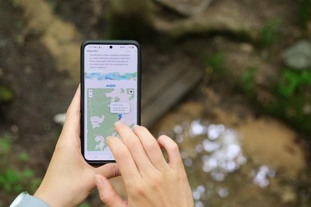
Everyone can participate in the project by accessing the RiverWatch web app: https://river-watch-unistrapg.hub.arcgis.com/pages/6b50c33a5aeb4afe81c41b4a9faf18a6
and going through the tutorial.
The app can be used to take images of and tag plastics in any river in the world!
Insights and Highlights
Data gathered by citizens are uploaded onto an online platform featuring: i) an interactive map of the drainage network; ii) a dashboard to visualize data; and iii) a public dataset for data download. Different layers relative to data types and temporal aggregation are made visible/hidden on the map by interactive ticking of the legend boxes by the user. Further, a dataset is regularly updated on the web platform with processed data as well as raw images. This material is usable by the public as well as the scientific community for further processing and algorithm development.
Participants are recruited through events organized by local stakeholders, webinars/seminars in schools for teachers and students.
The RiverWatch app is a scalable system to monitor the state of our rivers that relies entirely on citizens. Its ease of use is fundamental to create large datasets that refine computer vision algorithms for automatic estimation of plastic discharge.
About funding
Funding bodies: Italian Ministry of University and Research
Funding program: PRIN2022
Coordinator

Università per Stranieri di P…
Academic
Water type
Keywords
Science Topics
Tags
Difficulty Level
Participation tasks
Location
Contact
Similar projects

PreserVamos
No organization
13/11/2025

Plastic Pirates - Go Europe!
No organization
01/10/2025
AquaCoLab - Burgos
24/11/2025
CrowdWater
27/10/2025
Home River Bioblitz
No organization
11/02/2026